![people[PLACES]spaces](http://images.squarespace-cdn.com/content/v1/576721b9c534a524caa154f1/1468892964341-A2P4OC3DSF0Q7HXIUYI7/Logo+%281%29.jpg)
First Impressions: Los Angeles State Historic Park

First Impressions is an occasional series about new buildings, public spaces, or urban places. First Impressions represents a different approach to the typical “review” or “critique.” We recognize that the full story of the success or failure of a space or place can only be told over time. So rather than serving as the final word on a given design, First Impressions is the beginning of a conversation.
It seems especially appropriate to launch our new First Impressions series with the Los Angeles State Historic Park. The new park, which opened just over two weeks ago in Los Angeles’ Chinatown neighborhood, is still something of a work in progress. The park officially opened on Earth Day, April 22, 2017, and when I visited a week later there were still signs of ongoing work. Handfuls of potted plants awaited their permanent homes, a future “snack shack”—or maybe a beer garden?—has yet to arrive, and eventual connections to Broadway and possibly even the L.A. River remain in the distant future. Despite its location in the heart of Los Angeles, remnants of the area’s industrial past leave the park relatively disconnected from the surrounding communities. But the simple and generous layout, and a location in a vibrant and thriving neighborhood suggest a bright and promising future for the LASHP.
This former rail yard provides what seems to be the ideal setting for an expansive open space, but it is only thanks to the tireless work of community activists that this park even exists today. Once planned as a complex of warehouses, public pressure spurred the state to purchase the land and establish it as a state park in 2001. Over the subsequent sixteen years, some of the more ambitious plans for the site had to be scaled back as a result of the 2008 financial crisis. Now, after a long wait, the reopened park provides a welcome open space, joining Chinatown with a rapidly changing industrial quarter.

The tree-lined promenade adds an unexpected formality to an otherwise casual park.
Entering the park from the southwest, a stone’s throw from the Chinatown Gold Line station, a tree-lined walkway delineates one edge of the park. The precisely paired trees on either side of the path create a formality that is unexpected in typical contemporary landscape design, and provide a pleasant contrast to the informality of the rest of park. Two small matching buildings occupy bends in the walkway, providing essential services such as restrooms and space for park staff. Their curving concave roofs and downspouts leading to underground cisterns make even this rain-averse Angeleno eager to return on a rainy day to see these water collection features in action.

The concave roofs of the park buildings channel rain water through stone-covered grates into underground cisterns.
At the midpoint between the two park buildings, a grove of orange trees forms the art installation entitled “Monument to Sharing” by Fallen Fruit. Each tree is planted within a large industrial-looking metal planter, inscribed with quotations from local residents in their preferred languages, providing a welcome reminder of L.A.’s diverse community history.

"Monument to Sharing" art installation by Fallen Fruit.
In one of the few shortcomings of the park’s design, the otherwise elegant path culminates rather unceremoniously at the parking lot. For those arriving by car, the walkway serves as an alternative entrance to the park, but for anyone visiting on foot the parking lot becomes the anticlimactic “destination” of the path.
Beyond the parking lot, the concrete paver walkway transitions to an elevated boardwalk extending over a re-constructed dry creek bed. Here the formality of the promenade meets the informality of the watershed. On the day of my visit, the only water in the channel came from the park’s irrigation system, which—as signage throughout the park eagerly reminds visitors—uses exclusively recycled water.

A constructed creek bed only collects (recycled) irrigation water on the day of my visit.
The bulk of the park is given over to sprawling lawns, punctuated by artificial hills and interspersed with small groupings of trees and gently curving walkways. In general, it’s just the right kind of urban park, providing ample space and a variety of conditions so that visitors feel free to use it as they please. Combined with this free-form space are more functional elements: the sidewalk along Spring Street and a pathway running between the park and the train track form an uninterrupted course for runners, walkers, or bicyclists; signage throughout the park provides reminders of the history of the site, complete with QR codes that link to more information.
Perhaps the signature feature of the park is the elevated walkway that forms part of circle outlining the location of a former roundhouse on the site. This walkway does not lead anywhere, but is rather a destination in its own right. The raised platform provides uninterrupted views across the park, to the downtown skyline beyond, and has already become a coveted destination for social media photos.
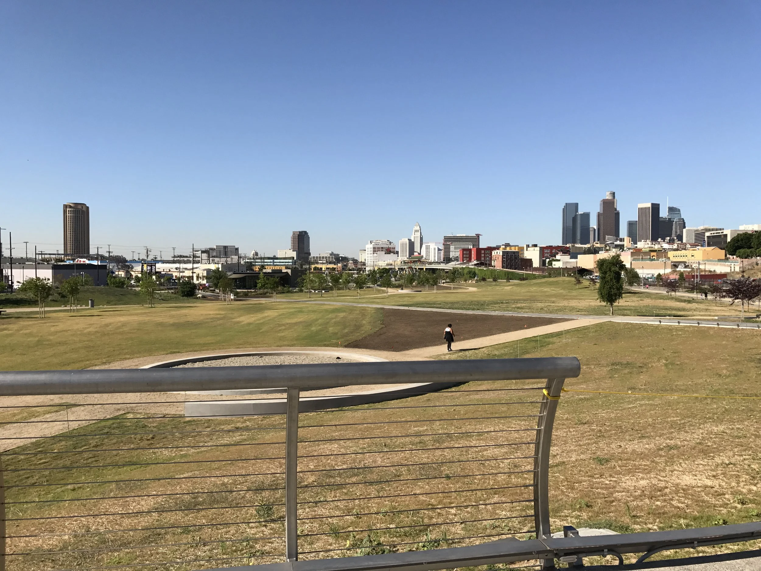
The elevated walkway provides views of the downtown skyline.
The one significant flaw in the park has little to do with its overall design, and more to do with the nature of its location. The park is hemmed in by the Metro Gold Line tracks to the north, and the wide, busy thoroughfare of Spring Street on the south, limiting access points from the surrounding communities. The connection to Spring Street is further diminished by a wide dead-zone between the park and the street, left undeveloped apparently due to the presence of an underground petroleum pipeline. But perhaps the greatest sacrifice of the state budget cuts was a planned pedestrian bridge crossing the Gold Line tracks to connect the park to Broadway and the core of Chinatown. Although the design of the park anticipates a future connection to Broadway (when more funds are available), there is currently only one option for pedestrian access at the southwest corner of the site. Visitors arriving by train or car have convenient entry points to the park, but local residents are left with circuitous paths to access the space. Chinatown residents must pass through or around the Metro station to access the park, and for workers and residents across Spring Street there are no pedestrian crossings anywhere along the nearly mile-long length of the park. Gates along the south side of the park are labeled with the names of cross streets on the other side of Spring Street, anticipating a future with improved connections, but that future seems far off.

The Chinatown Gold Line station provides an impressive overview of the park.
Despite these access flaws, the Los Angeles State Historic Park seems poised to become a destination in its own right. After nearly two decades of concerted community organization, the park has finally opened in its near-complete form. The groups that fought so hard to make this park a reality should be celebrated for their accomplishment, and I hope that that same spirit of activism will encourage improved community connections and pedestrian access to the park in the future. The state parks department should make the planned connection to Broadway sooner rather than later, and the City of Los Angeles should complement the state’s contribution with safe pedestrian access across Spring Street. In the meantime, LASHP is sure to find many new fans in local residents and more far-flung Angelenos alike.


